
In-depth guide to 3D scanning for civil engineering and infrastructure maintenance


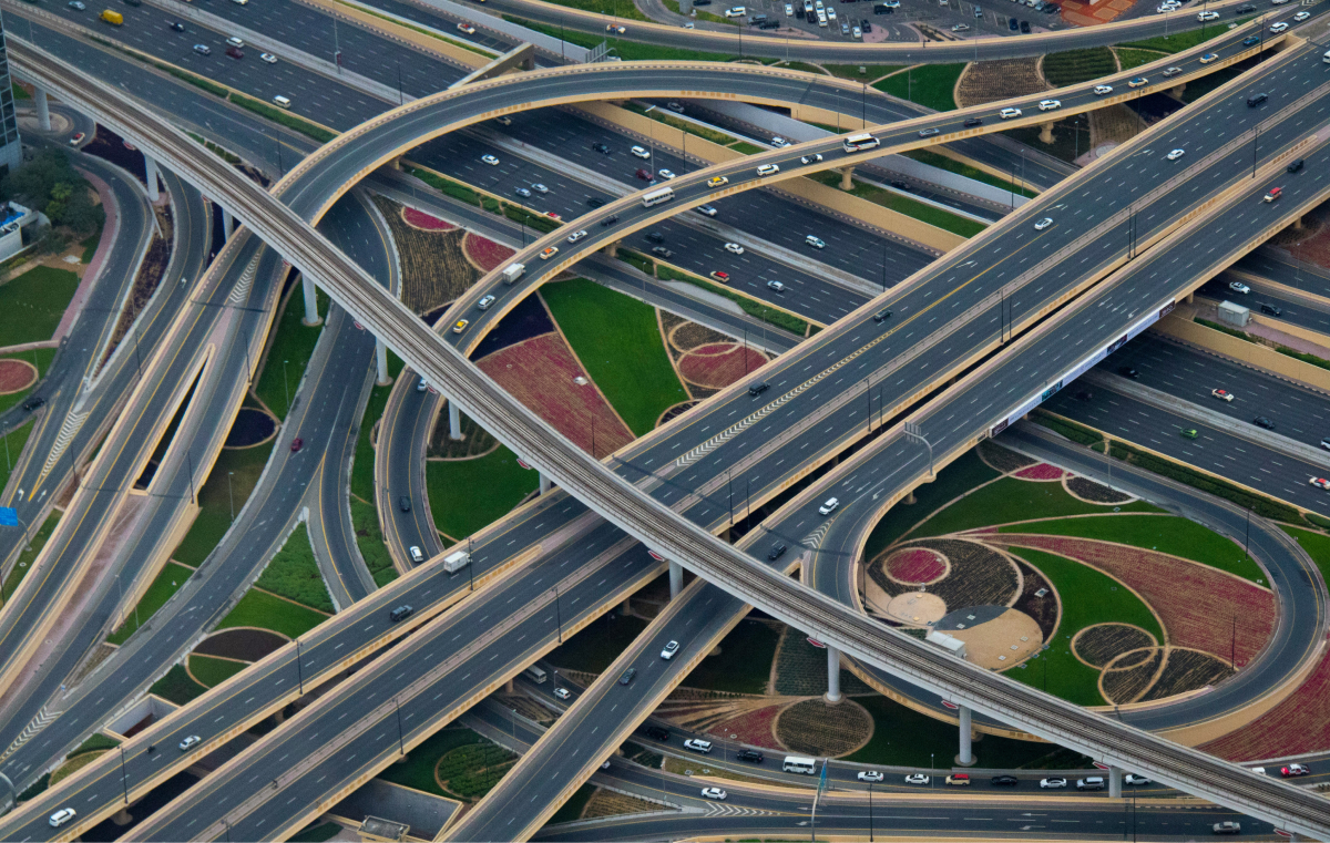
Civil engineering and infrastructure are critical to local communities and regional economies, but they also represent some of the most complex, large-scale and expensive projects in any industry. Maintenance, repair or renovation of highways, railways, bridges, airports, ports, and tunnels pose a unique set of challenges in terms of operational complexity, scale of material, and on-site safety.
One way to deal with all of these challenges is by acquiring accurate information about sites and structures with 3D scanning technology.
In this blog, we explore how 3D scanning can help with the needs of civil engineering and infrastructure projects, take a detailed look at the advantages it delivers and review the devices and processes involved.
Uses of 3D scanning in civil engineering and infrastructure
In general, 3D scanning applications in civil engineering applications involve a large piece of infrastructure that must be assessed as the first step in a complex process. Some of the most common applications include:
As-built modelling
No infrastructure project is constructed exactly as intended by the original plans, and every piece of infrastructure undergoes a variety of changes over time. An as-built model is intended to capture an accurate model of how a structure looks at a specific point in time to allow professionals to conduct safety inspections, assess wear and damage, and determine the best approach for repair or reinforcement.
Reverse engineering
For many reasons, accurate documentation of existing structures may be lost or incomplete. In these cases, 3D scanning is used to understand large, complex structures in detail so that their form and function can be reverse engineered into an accurate 3D model that will drive repairs, reinforcements or full replacement. Reverse engineering also helps understand the precise alignment of structural elements that move, like swing bridges.
Mobile inspection
Infrastructure projects frequently involve evaluating dozens or even hundreds of miles of paved roadway or rail line. This is typically done to inspect for safety concerns, such as the height of barriers or bridge decks from the roadway, or to detect potential clashes between trains and tunnels, other structures or overhanging vegetation.
Monitoring
During large-scale infrastructure projects, 3D scanning can be used periodically to keep tabs on the progress of the build and ensure it is proceeding correctly.
Advantages of 3D scanning
There are many reasons why 3D scanning has emerged as the preferred solution for on-site data capture in civil engineering and infrastructure. Traditional methods of recording the dimensions of large civil structures were manual, using tape measures and other tools. Compared to this approach, 3D scanning offers several important advantages, including:
Access
Many pieces of civil infrastructure, especially very large ones, are difficult if not impossible to access directly. This eliminates the possibility of traditional data capture by means of portable coordinate measuring machines (CMMs) or physical measurement devices. In these cases, a long-range or terrestrial 3D scanner can be mounted on a tripod a sufficient distance away and still capture all of the required data from the structure.
Safety
From highways to railways to energy infrastructure, many of the assets that must be scanned in civil engineering applications are dangerous. Accurate 3D scanning is typically faster than traditional methods, which helps minimise the number of people involved in the scanning as well as the total time spent exposed to a dangerous or risky area. As we will see shortly, mobile scanning can also be used to keep measurement teams entirely out of harm’s way.
Speed
Unless the request is for very basic dimensions of a structure, 3D scanning is much faster than traditional manual measurement tools. While this helps improve safety, it is also critical to the overall efficiency and productivity of the job. Not only do teams spend less time on site acquiring data, but the eventual 3D CAD model can be shared with any other team through a variety of digital means.
Accuracy
3D scanners can capture data to within a millimeter of accuracy for mobile applications down to the submicron level. Importantly, they capture millions of data points from complex structures, enabling the creation of highly accurate 3D models in which any point can be further interrogated. Overall, 3D scanning automatically delivers a much more complete and reliable data set that eliminates the human errors that are common with traditional methods.
3D scanning devices for civil engineering
Depending on the application, 3D scanning teams can use a different type of scanner or combination of scanners. Common options include:
Terrestrial laser scanners
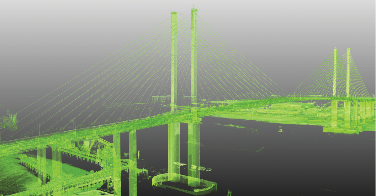
These stationary devices capture 3D scan data from a fixed position, such as a tripod mount. The scanning technology in terrestrial scanners is called light detection and ranging, or LiDAR, which shines a laser at the surface of an object and measures how long it takes for the light to return. Each of these reflections is recorded in a point cloud that contains millions of data points with accuracy to approximately ±1mm. These points can then be combined to create a detailed, highly precise 3D model of the structure.
Metrology-grade laser scanners
These devices capture millions of data points very quickly (within seconds) like terrestrial scanners, but at a much higher level of detail — often to 50 microns of accuracy. They use the same laser technology as terrestrial scanners but are typically smaller and more portable. Because they are “metrology grade,” they must meet rigorous industry standards for accuracy and other important factors.
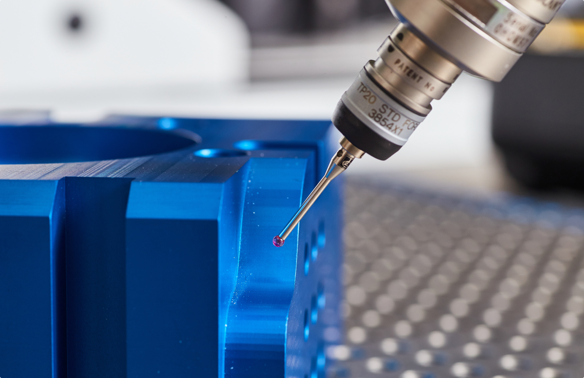
Portable CMMs
In certain situations, it can be advantageous to use a portable CMM, which can achieve an even higher degree of accuracy than laser scanners (sub 50 microns) but require a probe to touch the object. The CMM may use sensors and computation to pinpoint the precise position of the probe relative to an origin point. The most common configuration is an articulated arm that must be moved manually by the operator.
Mobile scanners
Mobile scanners use LiDAR technology to acquire 3D scan data from a moving vehicle. These systems are essential for maintaining operator safety in situations when teams need to scan long stretches of roadway. Capturing accurate 3D scan data at highway speeds is much more efficient than any other collection method.
Transforming scan data into 3D models
Once the 3D scan data is captured, it must be transformed into a more usable format in order for it to be investigated or analysed. The raw files are generally too large for any other software application to handle them, in terms of computation and storage.
Adjusting the coordinate system
The first step in this process is often done by software that is specific to the type and brand of scanner. It converts the geospatial coordinate system of the structure to one that is intelligible to CAD modelling software.
Building Information Modelling
After this conversion, many other software applications can interact with the 3D scan data. Typically, the intent is to turn the 3D scan data into a 3D model. Traditionally, civil engineering and infrastructure applications would use scan-to-BIM software. Building information modeling (BIM) applications, however, are more appropriate for new construction as their primary goal is creating a digital replica of the building that can be accessed by various stakeholders.
Parametric CAD
For most civil engineering and infrastructure scanning projects, a 3D CAD model is the preferred outcome as it is essential for as-built modeling, reverse engineering, and other critical applications, making the raw 3D scan data less useful on its own. Metrology software like Geomagic Design X streamlines the process of converting 3D scan data into a 3D CAD model by allowing users to efficiently select the appropriate point density, remove overscan, and generate models directly from point cloud data using a mix of automated tools and guided processes such as solid model extraction, surface fitting, and mesh editing.
Opportunities for scanning in civil engineering & infrastructure
3D scanning offers enormous potential for civil engineering and infrastructure projects. In fact, it’s already routinely used in bridge maintenance, to inspect industrial facilities and to capture general infrastructure data. Learn more about this use case on the 3D scanning software for civil engineering page.
Author

Top stories in Metrology & measurement

Automated quality: A new era of possibility

What’s the difference between ‘digitise’ and ‘digitalise’?
Related Metrology & measurement

Charting a course: Exploring the future of portable metrology

How additive manufacturing and 3D scanning improves product quality

Digital twins: The backbone of robotics deployment

Understanding and Improving the Effectiveness of Your CMMs
For quality that touches people's lives
Hexagon’s Manufacturing Intelligence blog is your go-to source for the latest manufacturing thinking. From expert commentary to industry perspectives, it’s designed to empower leaders and professionals to make smarter decisions, drive innovation and turn ideas into impact.